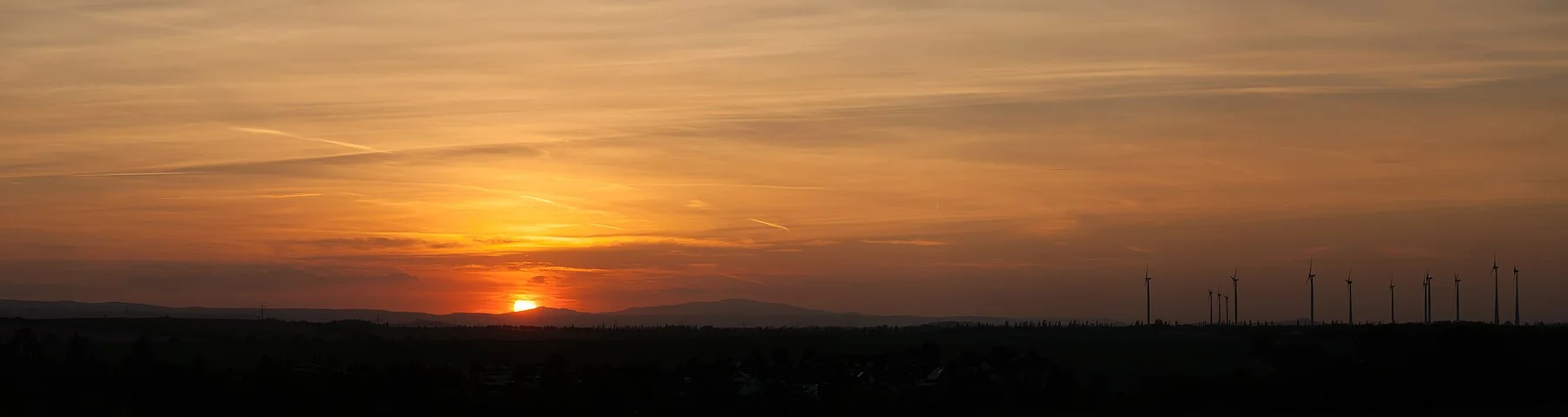
Carpathian borderlands

Bieszczady

Rounded Carpathian ridges, beech forest and sparsely settled valleys form one of Poland's strongest landscapes for long, reflective walking.

MountainsForestBorderlands

Location
Eastern Carpathians, Poland
Best window
May-Oct
Suggested stay
3-6 days
Go for
Long ridge solitude
The reason to go

Mountains defined by space rather than altitude

The Bieszczady feel remote because open polonyna ridges rise above broad forests and valleys marked by layered Polish, Ukrainian, Lemko and Boyko histories.

Stay long enough to connect Bieszczady's headline landscape with one quieter local route rather than treating it as a single viewpoint.

Look a little closer

Worth discovering

The details that make Bieszczady different.

Destination view
01

Polonyna ridges

High grasslands create broad walking lines above the forest, with views that extend across several national borders.

Destination view
02

Absent villages

Old church sites, cemeteries and fruit trees sometimes mark settlements displaced or abandoned during the twentieth century.

Destination view
03

Dark eastern skies

The region's low settlement density supports some of Poland's clearest night-sky viewing.

Photo journal

A closer look at Bieszczady

4 photographs
Deep background

A deeper history of Bieszczady

Rounded Carpathian ridges, beech forest and sparsely settled valleys form one of Poland's strongest landscapes for long, reflective walking. The view is only the surface of a longer story of formation, use and change.

The Bieszczady feel remote because open polonyna ridges rise above broad forests and valleys marked by layered Polish, Ukrainian, Lemko and Boyko histories.

Visitors often encounter Bieszczady through the idea of “Long ridge solitude”, but the destination is more than that single scene. Its landscape carries evidence of work, movement, adaptation and environmental change. At Bieszczady, allow enough time to connect Bieszczady's headline landscape with one quieter local route instead of reducing Bieszczady to a single viewpoint.

Continue to practical planning
Bieszczady, Połonina Caryńska in the evening 02See the complete photo journal
Origins

From underlying structure to visible landscape

At Bieszczady, the form of the landscape explains many of the choices that came later. Beech forest covers most slopes, opening suddenly onto rounded summit grasslands. River valleys, reservoirs and border ridges give the region a large scale despite moderate elevations.

Relief controls far more than the view. At Bieszczady, “Polonyna ridges” reveals how elevation divides vegetation, weather, water and the routes available to people. High grasslands create broad walking lines above the forest, with views that extend across several national borders.

Lives and livelihoods

How people learned to live here

Before the Second World War, Bieszczady valleys contained a dense mosaic of Boyko, Lemko, Polish and Jewish communities. Wooden churches, narrow fields, orchards and seasonal grazing tied villages to both sides of the Carpathian border, while the open polonyna ridges supported pastoral use above the beech forest.

War, the Holocaust, Polish-Ukrainian conflict and post-war border changes destroyed that social landscape. In 1947 Operation Vistula forcibly resettled many remaining Ukrainian, Lemko and Boyko inhabitants to western and northern Poland. Villages disappeared, fields returned to forest and cemeteries, church foundations and fruit trees were left without houses around them.

Reorganisation

The transition visible today

Creation and later expansion of Bieszczady National Park protected a landscape whose apparent wildness is partly the result of forced depopulation. Reintroduced bison, abandoned village sites and tourist trails now occupy terrain where cultural loss and ecological recovery cannot be separated.

Field notes

What to read in the landscape

At Bieszczady, the feature “Polonyna ridges” is best understood as part of the surrounding system rather than an isolated stop. High grasslands create broad walking lines above the forest, with views that extend across several national borders. At Bieszczady, it gives a concrete reference point for reading change rather than merely collecting viewpoints.

Start with the feature “Absent villages”, because it condenses a much larger part of the story of Bieszczady. Old church sites, cemeteries and fruit trees sometimes mark settlements displaced or abandoned during the twentieth century. Its position and condition at Bieszczady connect physical history with the way people use the place now.

Start with the feature “Dark eastern skies”, because it condenses a much larger part of the story of Bieszczady. The region's low settlement density supports some of Poland's clearest night-sky viewing. For Bieszczady, that relationship is more informative than treating the feature only as a photograph or checklist item.

Present day

Season, scale and the present day

A single visit to Bieszczady captures only one phase of its annual cycle. June offers fresh green ridges, September and October bring strong forest colour, and summer weekends are busier on the best-known trails. Winter changes access completely.

For Bieszczady, the most useful time of day is: sunrise on a polonyna.

For Bieszczady, plan this first: trail base and return transport.

Placed within its wider geography, Bieszczady is not an isolated exception. For Bieszczady, the wider context shows that, the San Valley, wooden church routes and neighbouring Slovak and Ukrainian Carpathians expand the journey beyond the best-known image of Bieszczady summit walks.

Chronology

Key dates

  1. Multi-ethnic mountain villages

    Boyko, Lemko, Polish and Jewish communities farmed valleys and used high grasslands across a porous border region.

  2. War, border change and expulsions

    Violence and forced resettlement emptied many settlements, culminating in Operation Vistula.

  3. National park and rewilding

    Formal protection expanded across forests and polonyna ridges in a dramatically depopulated landscape.

In context

Get to know the place

The landscape

Beech forest covers most slopes, opening suddenly onto rounded summit grasslands. River valleys, reservoirs and border ridges give the region a large scale despite moderate elevations.

People and place

Contemporary mountain communities sit within a culturally complex borderland where wooden churches, pastoral traditions and post-war resettlement remain visible in the landscape.

Seasonal character

June offers fresh green ridges, September and October bring strong forest colour, and summer weekends are busier on the best-known trails. Winter changes access completely.

Beyond the main view

The San Valley, wooden church routes and neighbouring Slovak and Ukrainian Carpathians expand the journey beyond the headline summit walks.

Travel notes

Plan your visit

Time needed
3-6 days
Getting around
Car, regional bus and hiking
Effort
Moderate
Plan first
Trail base and return transport
Time of day
Sunrise on a polonyna
Best window
May-Oct
Keep exploring

Where next?

All place stories