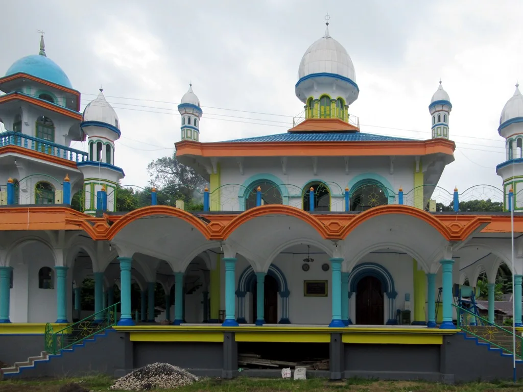
Bali above the coast

Munduk Highlands

Cool upland villages, waterfalls, coffee gardens and crater-lake views form a greener, quieter interior landscape in northern Bali.

WaterfallsCoffee gardensCrater lakes

Location
Bali, Indonesia
Best window
Apr-Oct
Suggested stay
2-4 days
Go for
Highland village and waterfall route
The reason to go

Munduk waterfalls

Several cascades lie within cultivated valleys, reached by paths that pass gardens and small settlements.

Check opening days or local access first, then connect the main site to the surrounding streets, paths or landscape instead of treating it as an isolated stop.

Look a little closer

Worth discovering

The details that make Munduk Highlands different.

Destination view
01

Munduk waterfalls

Several cascades lie within cultivated valleys, reached by paths that pass gardens and small settlements.

Destination view
02

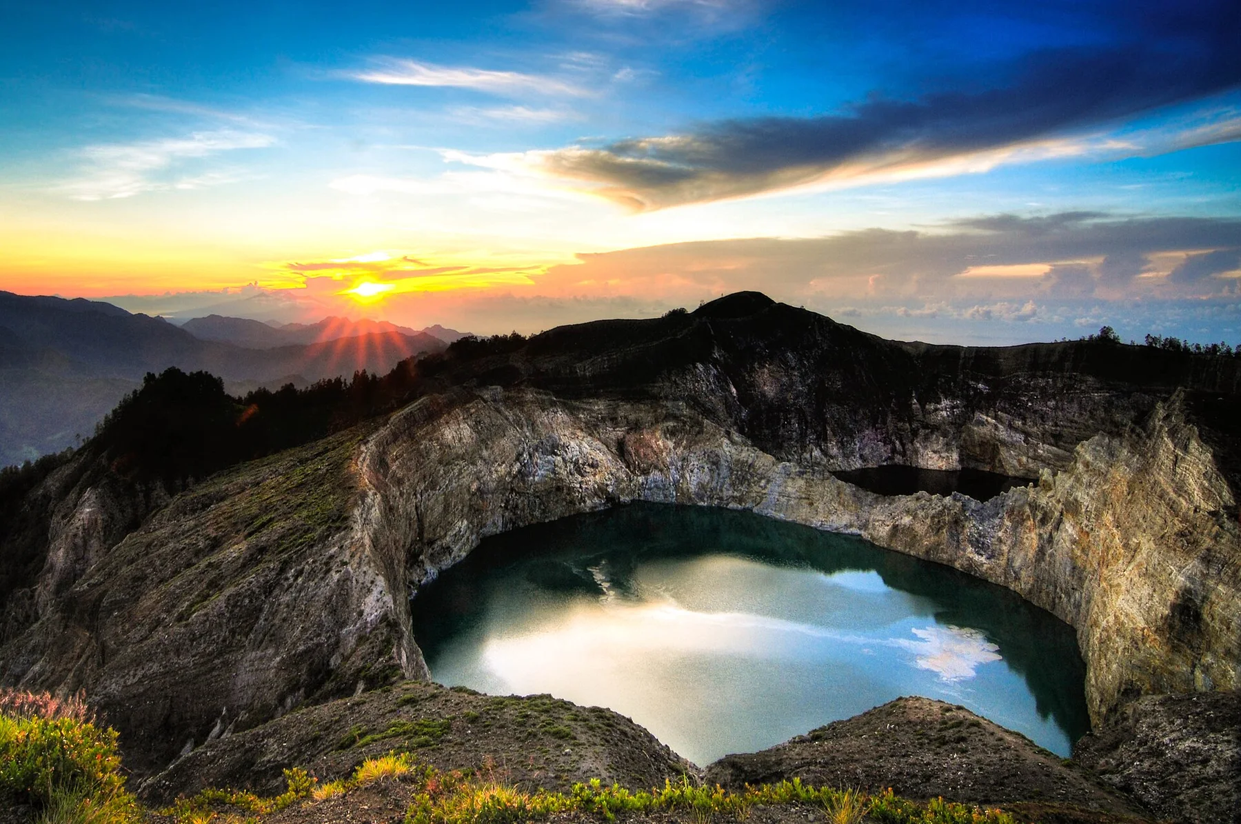
Twin-lake viewpoints

High roads reveal the volcanic basin and the forested separation between Buyan and Tamblingan.

Destination view
03

Coffee and clove landscape

Working gardens provide a direct link between local livelihoods and the green highland scenery.

Photo journal

A closer look at Munduk Highlands

9 photographs
Landscape and history

A deeper history of Munduk Highlands

Cool upland villages, waterfalls, coffee gardens and crater-lake views form a greener, quieter interior landscape in northern Bali. The deeper story links its visible features with the people and changes behind them.

Munduk Highlands is best approached through the relationship between its setting and its lived landscape. Munduk occupies a high ridge and valley system in northern Bali, far above the hotter coastal plains. Waterfalls, forest, clove and coffee gardens and views toward crater lakes create a landscape shaped by altitude and moisture. Villages follow ridges where breezes and long views are strongest.

Visitors often encounter Munduk Highlands through the idea of “Munduk waterfalls”, but the destination is more than that single scene. Its landscape carries evidence of work, movement, adaptation and environmental change. Several cascades lie within cultivated valleys, reached by paths that pass gardens and small settlements.

Continue to practical planning
Tamblingan - panoramioSee the complete photo journal
Origins

The physical foundations of the place

Before roads, settlements or protected-area boundaries, the terrain of Munduk Highlands set the basic terms. Steep paths descend through cultivated slopes toward streams and waterfalls. The nearby lakes Buyan and Tamblingan sit within an older volcanic landscape, surrounded by forest and mist. Agricultural terraces and garden plots soften the transition between village and woodland.

Water is not simply scenery at Munduk Highlands; it organises erosion, habitat and movement. “Munduk waterfalls” is where those roles become easiest to separate and understand. Several cascades lie within cultivated valleys, reached by paths that pass gardens and small settlements.

Human history

People, work and memory

At Munduk Highlands, people learned to work with the landscape limits rather than arriving after its story was complete. Coffee, cloves and other highland crops remain visible around homes and guesthouses. Temples, family compounds and village roads give the landscape a lived cultural structure. Tourism is smaller-scale than in southern Bali but increasingly important to household income.

At Munduk Highlands, the feature described as “Twin-lake viewpoints” offers a second line of evidence. High roads reveal the volcanic basin and the forested separation between Buyan and Tamblingan. Within Munduk Highlands, it shows how local knowledge and practical use became embedded in the landscape.

Modern history

The transition visible today

The decisive modern change at Munduk Highlands was access. At Munduk Highlands, transport and visitor infrastructure made the landscape easier to reach while concentrating pressure at the few points where roads, boats or trails enter it. At Munduk Highlands, the consequences are clearest where traditional use, protection and tourism occupy the same ground.

Field notes

The small features that reveal the larger pattern

At Munduk Highlands, the feature “Munduk waterfalls” is one of the most useful pieces of visible evidence. Several cascades lie within cultivated valleys, reached by paths that pass gardens and small settlements. At Munduk Highlands, it gives a concrete reference point for reading change rather than merely collecting viewpoints.

At Munduk Highlands, the feature “Twin-lake viewpoints” is best understood as part of the surrounding system rather than an isolated stop. High roads reveal the volcanic basin and the forested separation between Buyan and Tamblingan. At Munduk Highlands, it gives a concrete reference point for reading change rather than merely collecting viewpoints.

At Munduk Highlands, the feature “Coffee and clove landscape” provides a precise clue to how the landscape works. Working gardens provide a direct link between local livelihoods and the green highland scenery. For Munduk Highlands, that relationship is more informative than treating the feature only as a photograph or checklist item.

Season and scale

Season, scale and the present day

At Munduk Highlands, season is part of the landscape history, not merely a planning detail. The drier season is generally easier for walking, though waterfalls may be less forceful. Wet months intensify vegetation and cloud but make paths slippery. Temperatures are noticeably cooler than the coast, especially in the evening.

For Munduk Highlands, the main seasonal constraint is: the strongest planning window is Apr-Oct. For Munduk Highlands, outside it, check weather, daylight, road or ferry schedules and seasonal closures before committing to a fixed route.

For Munduk Highlands, one practical detail matters: cloud, wind and trail conditions can change quickly. For Munduk Highlands, put the highest or most exposed stop first and keep a lower-level alternative.

Placed within its wider geography, Munduk Highlands is not an isolated exception. For Munduk Highlands, the wider context shows that, munduk can be connected with the twin lakes, Bedugul and the north-coast plains. For Munduk Highlands, this vertical route reveals how quickly Bali changes from marine tourism zones to agricultural highlands and cloud forest.
Travel notes

Plan your visit

Time needed
2-4 days
Getting around
Car to access points, then walking or hiking
Effort
Moderate
Plan first
Opening days and any limited-entry sites
Time of day
Start early for clearer conditions and more time
Best window
Apr-Oct
Traveller stories

Stories from people who have been here.

First-hand moments, practical notes and overlooked details from Munduk Highlands.

Loading traveller stories…

Browse all traveller stories ↗

Keep exploring

Where next?

All place stories