Savanna between rainforest and tepuis

Rupununi Savannas

A vast savanna and wetland landscape between the Guiana Shield forests and Brazil, shaped by seasonal floods, ranches and Indigenous communities.

SavannaWetlandsCommunity travel

Location
Southern Guyana, Guyana
Best window
Sep-Apr
Suggested stay
4-7 days
Go for
Open Guiana Shield journey
The reason to go

A landscape connected by seasonal water and community knowledge

The Rupununi offers immense horizons, but its real depth comes from Indigenous territories, ranching history and the annual shift between dry grassland and flooded channels.

Stay long enough to connect Rupununi Savannas's headline landscape with one quieter local route rather than treating it as a single viewpoint.

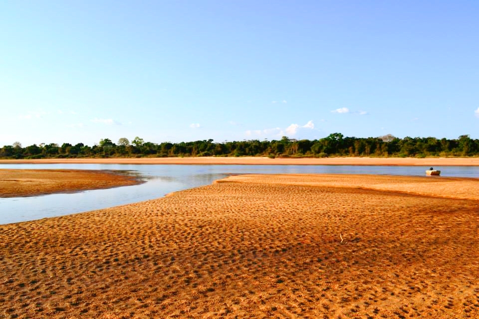
Look a little closer

Worth discovering

The details that make Rupununi Savannas different.

Destination view
01

A seasonal Amazon connection

During high water, parts of the Rupununi system can connect toward Amazonian drainage through flooded lowlands.

Photo journal
02

Giant wildlife

The region supports giant anteaters, giant river otters, black caiman and large birds across savanna and river habitats.

Destination view
03

Community-owned lodges

Several Indigenous communities operate tourism that links wildlife viewing with local guides, language and land management.

Photo journal

A closer look at Rupununi Savannas

4 photographs
Origins and change

How Rupununi Savannas became the place it is

A vast savanna and wetland landscape between the Guiana Shield forests and Brazil, shaped by seasonal floods, ranches and Indigenous communities. This account follows the forces, communities and decisions that made the present landscape.

Rupununi Savannas is best approached through the relationship between its setting and its lived landscape. The Rupununi offers immense horizons, but its real depth comes from Indigenous territories, ranching history and the annual shift between dry grassland and flooded channels.

Many visits to Rupununi Savannas begin with the experience described as “Open Guiana Shield journey”. The more revealing question is why it exists here, how people used the surrounding ground and what remains visible from earlier phases. At Rupununi Savannas, allow enough time to connect Rupununi Savannas's headline landscape with one quieter local route instead of reducing Rupununi Savannas to a single viewpoint.

Continue to practical planning
Sustainable wildlife management in the Rupununi, Guyana (P-043560-00-13)See the complete photo journal
Physical setting

The forces behind the first impression

The first layer of Rupununi Savannas is geological and ecological rather than scenic. Open savanna, gallery forest, wetlands, rivers and distant Pakaraima Mountains form a broad southern Guyanese basin.

The skyline is only the upper edge of a larger system. At Rupununi Savannas, “A seasonal Amazon connection” connects the high ground with valleys, settlement and the movement of water below. During high water, parts of the Rupununi system can connect toward Amazonian drainage through flooded lowlands.

Lives and livelihoods

The cultural layer of the place

The Rupununi is homeland to Makushi, Wapishana and Wai-Wai communities whose farming, fishing, burning practices and seasonal movement connect savanna, forest and rivers. Trails across the watershed linked the Amazon and Essequibo systems long before national borders divided Guyana from Brazil.

Cattle ranching expanded during the colonial period, creating large estates and vaquero traditions around Lethem and the open savannas. In 1969 an uprising by ranchers and Indigenous supporters challenged the Guyanese government; its suppression and the flight of residents into Brazil remain sensitive parts of regional memory.

Change

A landscape reorganised

Roads to Georgetown and Brazil increased trade and migration, while community conservancies created new ways to manage wildlife and tourism. Flooded wet-season grasslands, ranch compounds and Indigenous villages reveal overlapping land systems rather than a single empty plain.

On the ground

The evidence still visible on the ground

At Rupununi Savannas, the feature “A seasonal Amazon connection” is one of the most useful pieces of visible evidence. During high water, parts of the Rupununi system can connect toward Amazonian drainage through flooded lowlands. Its position and condition at Rupununi Savannas connect physical history with the way people use the place now.

Look closely at the feature “Giant wildlife” in Rupununi Savannas; it carries information that a panoramic view can miss. The region supports giant anteaters, giant river otters, black caiman and large birds across savanna and river habitats. Within Rupununi Savannas, the feature explains why this destination differs from nearby landscapes.

Look closely at the feature “Community-owned lodges” in Rupununi Savannas; it carries information that a panoramic view can miss. Several Indigenous communities operate tourism that links wildlife viewing with local guides, language and land management. For Rupununi Savannas, that relationship is more informative than treating the feature only as a photograph or checklist item.

Season and scale

A living landscape, not a frozen scene

A single visit to Rupununi Savannas captures only one phase of its annual cycle. The dry season improves road access and concentrates some wildlife, while the wet season transforms travel toward boats and flooded savanna.

For Rupununi Savannas, the most useful time of day is: dawn on the savanna.

For Rupununi Savannas, plan this first: community lodge and seasonal transfer.

Placed within its wider geography, Rupununi Savannas is not an isolated exception. For Rupununi Savannas, the wider context shows that, iwokrama forest, Kaieteur routes and Brazil's Roraima state show how the Rupununi links rainforest, savanna and tepui landscapes.

Chronology

Key dates

  1. Indigenous watershed routes

    Makushi, Wapishana and Wai-Wai communities connected river basins through trade, farming and seasonal travel.

  2. Ranching frontier expands

    Cattle estates and vaquero culture reshaped parts of the open savanna.

  3. Rupununi uprising

    A regional revolt and government response led to deaths, displacement and lasting political memory.

In context

Get to know the place

The landscape

Open savanna, gallery forest, wetlands, rivers and distant Pakaraima Mountains form a broad southern Guyanese basin.

People and place

Macushi and Wapishana communities, cattle ranches and border trade shape the region, with travel often organised through local lodges and airstrips.

Seasonal character

The dry season improves road access and concentrates some wildlife, while the wet season transforms travel toward boats and flooded savanna.

Beyond the main view

Iwokrama forest, Kaieteur routes and Brazil's Roraima state show how the Rupununi links rainforest, savanna and tepui landscapes.

Travel notes

Plan your visit

Time needed
4-7 days
Getting around
Small aircraft, 4x4 and boat
Effort
Moderate
Plan first
Community lodge and seasonal transfer
Time of day
Dawn on the savanna
Best window
Sep-Apr
Keep exploring

Where next?

All place stories